


AEC | June 2024
Drones in AEC Industry: Tackling Four Critical Issues

Introduction
The Architecture, Engineering, and Construction (AEC) industry is a dynamic sector that shapes our built environment. It involves a collaborative effort where architects design, engineers refine, and construction transforms ideas into tangible structures. This industry creates and maintains our country’s critical infrastructure—from buildings to roads.
However, like any other industry, the AEC industry faces its own set of challenges. In this blog, we will delve into four of the industry's main challenges and how drones are addressing them.
What are the main challenges in the AEC Industry?
The industry grapples with challenges that can lead to cost overruns, project delays, safety hazards, and negative environmental impacts. Some of the key challenges in the sector are listed below:
Inaccurate Site Data: Erroneous site data can lead to design flaws, cost overruns, and project delays.
Safety Concerns: Surveying large or hazardous areas exposes workers to potential dangers and liabilities.
Slow Data Processing: Traditional surveying methods may require time-consuming data processing, delaying project timelines.
Environmental Impact: Construction projects may negatively affect the environment, leading to additional regulations, permitting, and potential fines.
But what if there was a way to tackle these issues?
Drone technology is revolutionizing construction management by addressing critical issues innovatively. With the ability to capture and analyze 2D and 3D data, drones positively influence every stage of design and construction. They’re invaluable in AEC projects, streamlining planning, simplifying site management, and significantly reducing data collection time.
Tackling the Challenge of Inaccurate Site Data with Drones
In the Architecture, Engineering, and Construction (AEC) industry, inaccurate site data is a significant issue. This problem, often stemming from traditional data collection methods, can lead to design flaws, cost overruns, and project delays. Manual surveys and measurements, are prone to human error and can be time-consuming. Moreover, these methods may only sometimes be feasible for large or complex sites.
Drones offer a cutting-edge solution to this problem. With advanced sensors and imaging capabilities, drones can capture accurate, high-resolution site data from various angles and elevations. This data can then create detailed and precise 3D site models.
Drone-generated models serve multiple purposes in structural engineering. They provide accurate site dimensions and topography, monitor construction progress, and detect discrepancies early, preventing cost overruns and delays.
The Role of Drones in Addressing Safety Concerns
Surveying large or hazardous areas in this industry often exposes workers to potential dangers and liabilities. This not only jeopardizes the safety of the workers but also increases the company's legal liabilities.
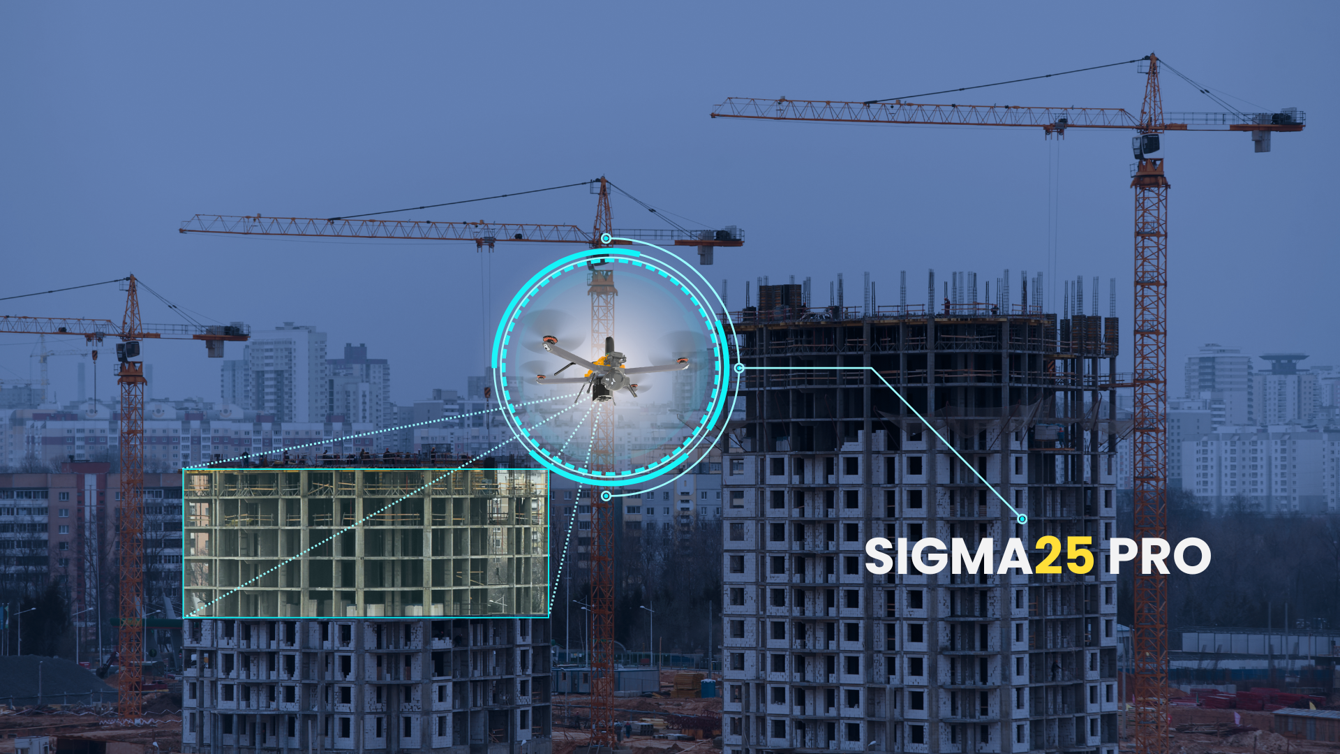
Figure 1: Remote Inspection by Drone
Drones aid this industry by offering safer and more efficient site surveys and inspections. They access hard-to-reach areas without risking personnel safety, minimizing accident risks, and ensuring a safer work environment. This increases productivity and efficiency. Additionally, drones reduce physical strain on workers by handling strenuous tasks, provide precise and continuous project updates, and help prevent dangerous incidents on construction sites.
Drones improve safety, efficiency, and working conditions in site planning, making them invaluable in modern construction and engineering projects.
Drones Streamlining Project Timelines
Infrastructure Development generates vast amounts of data, including architectural designs, structural plans, materials specifications, and project timelines. Traditional surveying methods involve manual data collection and processing, which can be time-consuming. This can lead to delays in project timelines, increased costs, and reduced efficiency.
Drones are revolutionizing project management by providing a faster and more efficient way to collect and process site data. Mapping of sites is possible in a fraction of the time compared to traditional surveying techniques. Ground control points and photogrammetry deliver more accurate results than ground measurements humans perform.
Drones in Mitigating Environmental Impact
Civil Engineering is known for its resilience and adaptability, but it also faces significant challenges in environmental conservation. Construction projects often involve activities that may harm the environment, such as deforestation, soil erosion, and pollution. These activities can negatively impact local ecosystems, contribute to climate change, and result in regulatory fines.
Drones provide detailed environmental surveys, creating high-resolution maps and 3D models to identify potential ecological impact areas. They collect baseline data, ensuring compliance with regulations from the project's start.
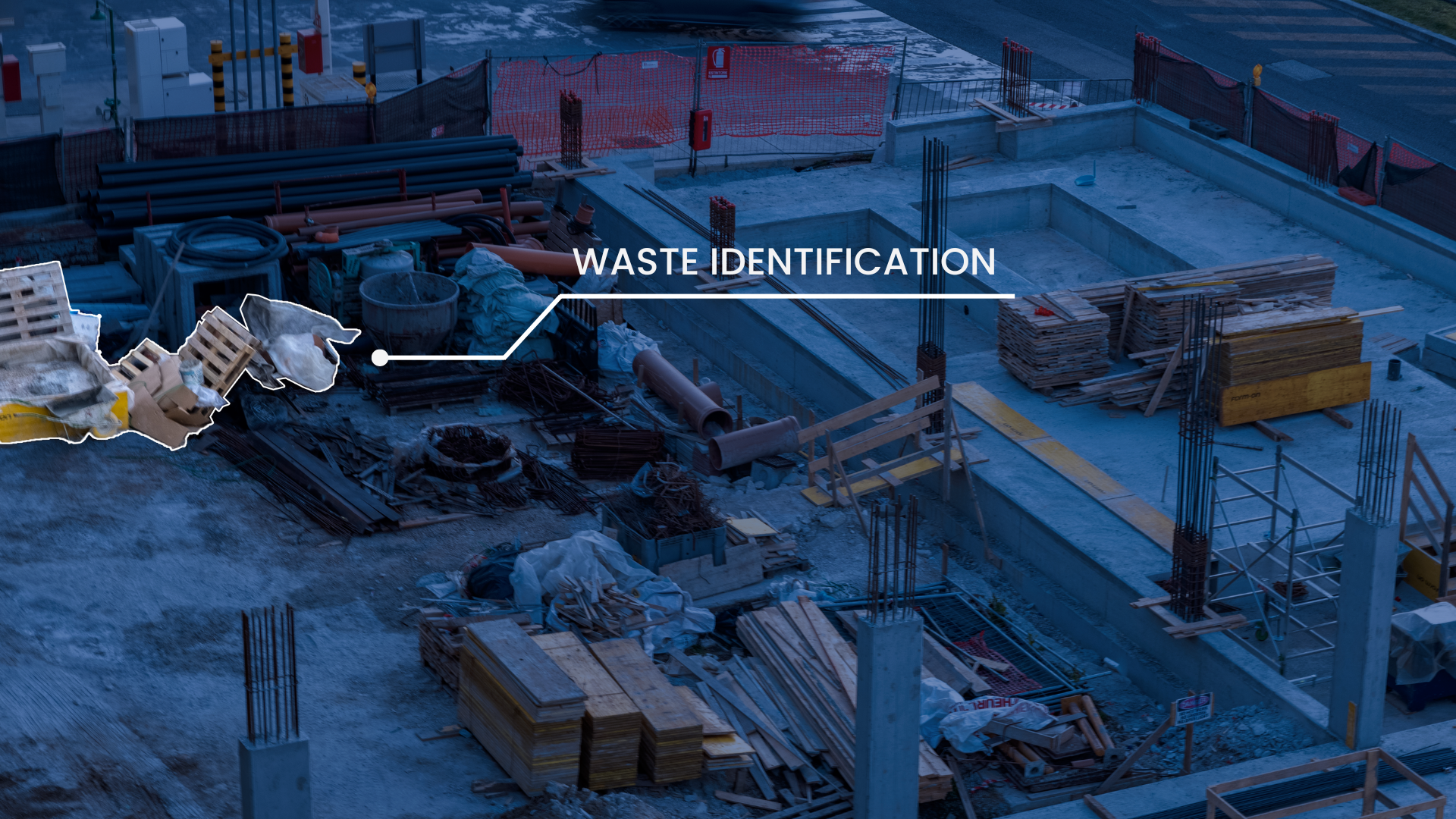
Figure 2: Waste Identification by Drone
Drones with air and water quality sensors monitor pollutants, helping sites meet air and water quality standards. They identify erosion-prone areas and monitor sediment control structures to prevent soil loss and waterway contamination. Additionally, drones survey waste management practices and ensure proper recycling. Their ability to automate data collection and reporting streamlines regulatory compliance, while their non-intrusive methods minimize environmental disturbance.
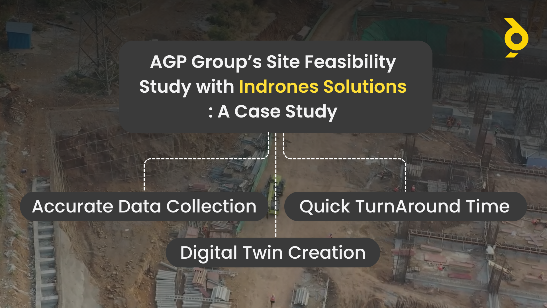
Brief Overview: AGP Group, a leading firm, partnered with Indrones Solutions to study the feasibility of a newly acquired site. The objective was to understand the site condition and present the findings to their stakeholders.
Problem Statement: The challenge was the vastness of the area, which made it time-consuming to cover using traditional methods. Moreover, not all stakeholders could physically visit the site to check its condition. The need was for a solution that could provide accurate site data quickly and in a format that could be easily shared with all stakeholders.
Solutions Offered: Indrones stepped in with its innovative drone technology and Eigenspace Suite.
a) The Sigma25 drone was used for data collection, providing a bird’s eye view of the site through live footage via Inflight.
b) A detailed 3D model of the site was created using Inspect, showing the area in the finest detail.
c) An orthomosaic model was also provided, allowing for measurements of each site element if required.
Outcomes:
Efficiency in Data Collection: Leveraging Indrones’ advanced drone technology, the client swiftly and accurately collected site data. This efficient method not only expedited the process but also conserved resources, demonstrating the transformative power of drone technology in data collection.
Digital and Shareable Data: The digital nature of the data facilitated easy sharing with other stakeholders in the firm. This was a significant advantage as it eliminated the need for all stakeholders to visit the physical site. The digital data could be easily integrated into presentations, reports, and collaborative platforms, promoting effective communication and stakeholder collaboration.
Effective Site Planning: The precise data from Indrones empowered the client to effectively plan the site. Detailed site insights facilitated informed decisions on resource allocation and operational planning, leading to optimized operations and enhanced project efficiency.
Understanding of Site Conditions: The client gained a comprehensive understanding of the site paths/routes and was able to inspect the site condition through the video and 3D model. This visual representation of the site provided a clear and detailed view of the site conditions, enabling the client to identify potential issues, plan necessary interventions, and monitor the progress effectively.
In summary, Indrones Solutions provided AGP Group with an efficient, effective, and environmentally friendly solution for site inspection and planning, leading to improved project outcomes and enhanced stakeholder communication.
Conclusion
Drones are transforming the AEC industry by addressing critical challenges in data accuracy, safety, efficiency, and environmental impact. Indrones Solutions exemplifies this transformation, offering advanced drone technology and innovative software to streamline site surveys and inspections. As demonstrated in our case study, their solutions enable faster data collection, enhance site planning, and facilitate stakeholder collaboration.
Embracing drone technology not only optimizes project outcomes but also ensures compliance with environmental regulations, making it an indispensable tool in modern construction and engineering.